
Short answer: floodwater pushes up on a slab and can wash soil out from under it. Around Sugar Land, the mapped floodplain reaches into most towns, and many neighborhoods sit behind levees that lower the risk but don't remove it. Look up your own address on FEMA's map. If you're planning a big repair on a floodplain lot, check the 50% rule first, because it can mean raising the house.
What our data shows
- In Sugar Land, 6 of our 24 sample spots fell in FEMA's 1% annual chance floodplain. Another 12 sit in an area FEMA labels as having reduced flood risk due to a levee.
- Across the Brazos River bottom towns, 57 of 147 spots fell in the floodplain. On the Katy terrace, it was 4 of 71.
- The Brazos at Richmond crested at 55.19 feet in Hurricane Harvey, the highest since regulation of the river began in 1940.
- Fort Bend County requires a new or substantially improved home in the floodplain to sit at least 2 feet above the base flood elevation.
What Floodwater Does to a Foundation
FEMA's homeowner guide on flood retrofitting, known as P-312, lays out the forces plainly.
- Standing water pushes. Still water presses on walls and slabs. It presses harder the deeper it gets. FEMA calls this hydrostatic pressure.
- It pushes up, too. Water, including water soaking the soil under a house, pushes up on floors. FEMA calls that buoyancy.
- Moving water pushes harder. River floods can run 5 to 10 feet per second. At 10 feet per second, that's about 7 miles per hour.
- It carries soil away. FEMA says erosion and scour can remove the soil that supports a foundation.
- Fast changes do damage. When water rises or falls faster than it can flow in or out, the pressure inside and outside doesn't match.
FEMA's guide doesn't describe what flooding does to swelling clay in particular, and we haven't found a federal source that does. What the USDA says about local clays still helps. Water runs into Lake Charles clay quickly when it's dry and cracked, then barely moves once it's wet. Brazoria clay, the Brazos River bottom's main soil, floods "rarely or commonly, except where protected," in the survey's words.
After a flood, let the ground dry before anyone measures the floors. A reading taken on soaked clay may not match the same house a month later.
The same slab on dry clay and on wet clay

- Dry soil pulled back from under one edge of the slab, leaving a small gap
- Fine cracks running down into the dry soil
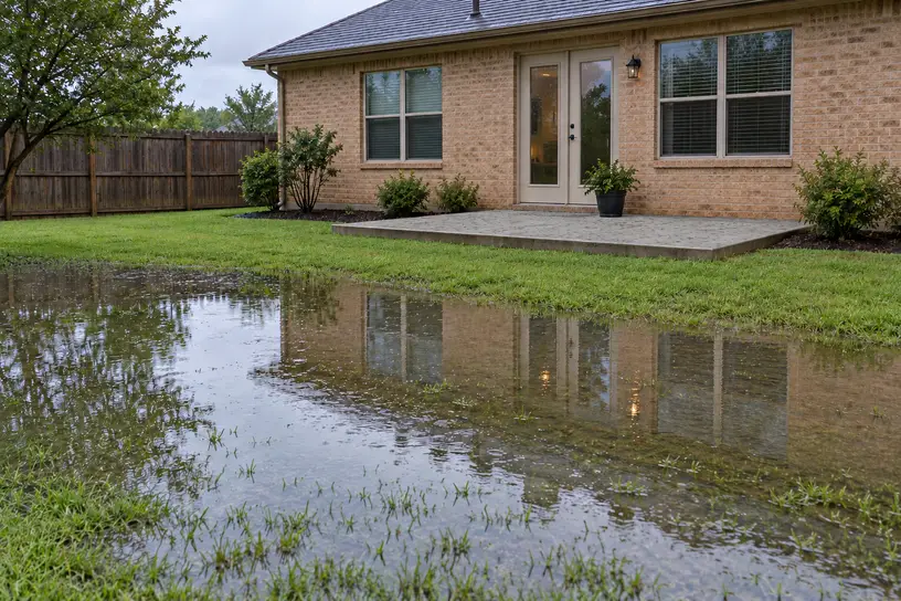
- Rainwater standing on the ground beside the slab
- Darker, wet soil filling right up to the underside of the slab
How Much of Each Town Is in the Floodplain
We checked FEMA's National Flood Hazard Layer at 25 spots in each town we studied, leaving out spots that fell on water. Here's how many landed inside the 1% annual chance floodplain. This is a sample of each town, not a count of homes, and it never tells you about one street.
River bottom
- Simonton: 16 of 24
- Richmond: 11 of 24
- Pecan Grove: 10 of 25
- Sienna: 9 of 25
- Sugar Land: 6 of 24
- Weston Lakes: 5 of 25
Coastal prairie
- Iowa Colony: 14 of 25
- Cumings: 13 of 25
- Pearland: 11 of 25
- Rosenberg: 7 of 25
- Manvel: 6 of 25
- Missouri City: 5 of 24
- Meadows Place: 4 of 25
- Arcola: 4 of 25
- Stafford: 2 of 24
- Fresno: 2 of 25
- Four Corners: 1 of 24
- Needville: 1 of 24
Katy terrace
- Fulshear: 2 of 25
- Cinco Ranch: 1 of 21
- Katy: 1 of 25
We left Mission Bend out. The rock map marks several of its spots as water that the soil survey reads as land, so its count would rest on spots we can't pin down. A low count doesn't mean no risk, either. Katy's 1 of 25 doesn't mean Katy has no floodplain.
Reading Your Own Flood Zone
Look up your own address
- Go to FEMA's Flood Map Service Center at msc.fema.gov.
- Type your address in the search box, which asks for "an address, place, or coordinates."
- Note the flood map number and its effective date. Maps change, so the date matters.
- Print a FIRMette, a one-page piece of the official map, or open the National Flood Hazard Layer viewer from the same results page.
What the zone letters mean, in FEMA's terms:
- A, AE, AH, AO: inside the special flood hazard area, with a 1% chance of flooding in any year. FEMA puts that at a 26% chance over a 30-year mortgage. AE shows a base flood elevation, the height water is expected to reach. AO gives a depth, 1 to 3 feet, instead.
- Shaded X: a moderate hazard, between the 1% flood and the 0.2% flood.
- Unshaded X: minimal hazard.
FEMA is blunt that "there is no such thing as a 'no-risk zone.'" It also warns that drains can back up in heavy rain and flood homes outside any mapped floodplain.
Levees and Levee Districts
Much of the area relies on levees. A levee improvement district is a local government that Texas law lets build levees and drain the land behind them. The City of Sugar Land says nine of them operate over most of the city:
- First Colony LID says it protects more than 8,500 residences, schools and businesses in parts of Sugar Land and Missouri City.
- Fort Bend County LID 2 says it runs 11 miles of levees and three pump stations, protecting over 9,000 homes in major portions of Sugar Land.
- Fort Bend County LID 7 covers New Territory, with about 3.75 miles of levees, the district says.
- Fort Bend County LID 14 keeps the lakes in the Avalon subdivision for storm detention.
- First Colony LID 2 (The Commonwealth), LID 10 (whose own site greets RiverPark residents), LID 11, LID 15 and LID 17 round out the city's list.
Outside Sugar Land, the Sienna Parks and Levee Improvement District covers Sienna, and Pecan Grove's levee belongs to its utility district.
Levee districts 6 and 20 sit in Richmond's extraterritorial jurisdiction. Cinco Ranch's drainage is run by the Willow Fork Drainage District. In Pearland, it's Brazoria Drainage District No. 4. Sugar Land's interactive map shows which district, if any, covers an address.
How a levee district drains
Fort Bend County LID 2 explains it. Flood gates in the levee open and close on their own, by water pressure. When the river rises higher than the water inside, they shut. From then on, every drop of rain inside the levee has to be pumped out. LID 15 and the Sienna district say their gates start closing when the Brazos reaches 39.9 feet at Richmond, below the 45-foot flood stage.
Two warnings come from the districts themselves. LID 2 says very heavy local rain can overwhelm its drainage and trap water in streets and yards, eventually reaching homes. LID 7 says the lowest parts of New Territory were hit hardest in Harvey by rainwater collecting inside the levee. FEMA adds that levees reduce risk without removing it, and that a failed levee can do more damage than no levee at all.
The Brazos River at Richmond
The National Weather Service's gauge at Richmond tracks the river for the whole area. Flood stage is 45 feet. Major flooding starts at 50. Those are readings on the gauge, not heights above sea level.
The highest crests since regulation began in 1940 came recently: 55.19 feet in 2017 (Harvey) and 54.74 feet in 2016. Before regulation, the river reached 61.2 feet in December 1913. In May 2024, it crested twice above 45 feet.
The Weather Service lists what happens at each stage. A few from its list:
- 46 feet: water over Baudet Road southeast of Richmond and Red Bird Lane in Fulshear
- 50 feet: homes in Richmond begin to flood
- 51 feet: Second Street in Richmond under water; low-lying streets on the west side of Quail Valley take on water
- 53 feet: FM 359 impassable between US 90A and the Pecan Grove levee; street flooding along Sienna Parkway
LID 7 adds a point worth remembering: rain that fell upstream keeps pushing the river higher, even after the rain at home has stopped.
Repairing a Foundation in the Floodplain: The 50% Rule
Here's where flood rules meet foundation repair. Federal rules call an improvement "substantial" when it costs 50% or more of the building's market value. A house that's substantially improved, or substantially damaged, must be brought up to the floodplain rules. That usually means raising the lowest floor.
Local rules build on that:
- Fort Bend County measures the 50% against the Fort Bend Central Appraisal District's value of the building. In the floodplain, the lowest floor must be at least 2 feet above the base flood elevation, or higher under its other tests.
- Sugar Land says it counts the total value of work over the past five years. Its floor rule is 2 feet above the Atlas 14 base flood elevation, or inside a levee district, 2 feet above the district's ponding level. The floor must also sit 1.5 feet above the ground and 1 foot above the curb.
- Missouri City counts "any repair" toward the 50% and requires 12 inches above the base flood elevation.
- Pearland requires 1 foot above the base flood elevation or the 500-year level, whichever is higher.
- Brazoria County has set floors 2 feet above FEMA's elevation since 2005.
A single foundation repair rarely tells the whole story here. After a flood, the repair bill adds to everything else being fixed. Before signing for major work on a floodplain lot, ask the city or county how they'll count it.
House Raising: What It Is and When It Fits
FEMA defines house elevation as raising a home so its lowest floor sits at or above the regulated flood level. Most homes are separated from their foundations, lifted on hydraulic jacks and held up while a new foundation is built below.
For a house on a slab, FEMA describes two ways. One lifts the house and slab together. The other leaves the slab and builds a new raised floor. FEMA says lifting with the slab attached is "technically challenging and often not feasible."
Slabs are usually 3½ to 6 inches thick, often reinforced only with wire mesh, and aren't built to span. FEMA says a structural engineer should evaluate the slab first, and only a highly skilled contractor should do the lift. For lifts of a few feet, a new slab poured on fill over the old one is another option.
A few more points from FEMA and the city:
- FEMA's grant programs fund elevation only to at least 1 foot above the base flood elevation in most cases.
- Sugar Land's floodplain page says raising a house often leaves an enclosed area below flood level, which needs flood vents and water-resistant materials.
- We found no reliable published cost for raising a house in this area.
House raising is its own specialty, separate from foundation repair. If you're weighing it, start with an engineer.
Flood Insurance and Your Mortgage
FEMA says flood insurance must be bought for homes in the special flood hazard area that carry a federally backed mortgage. Sugar Land puts it as "generally requires." The height of your lowest floor compared with the base flood elevation is what sets the premium.
Communities can earn discounts on flood insurance. First Colony LID says Sugar Land holds a Class 6 rating, worth 20%, and Missouri City a Class 7 rating, worth 15%.
Questions About Flood Zones and Foundations
My house is in zone X. Can it still flood?
Yes. FEMA says no zone is risk-free, and drains can back up outside the mapped floodplain. Shaded X is a moderate hazard; unshaded X is minimal.
Does a levee mean I don't need flood insurance?
Not necessarily. Homes in FEMA's levee-protected zone X sit outside the special flood hazard area, where the federal purchase rule applies. Still, FEMA says levees reduce risk and don't eliminate it. The Sienna levee district tells residents, "Remember, we are behind a levee!"
Should I repair my foundation right after a flood?
Let the ground dry first, then measure. Soaked soil can give readings that won't hold. If the house was damaged, check the 50% rule before major work.
Who do I call about my flood zone?
Your city's floodplain manager, or for unincorporated areas, Fort Bend County Engineering at 281-633-7500. FEMA's map service center has the official maps.
For the ground itself, see our soil guide. For regional sinking, which also changes flood risk, see the subsidence guide. Permit rules are in the permits guide, and you can go back to the Sugar Land homepage.
Sources
- Homeowner's Guide to Retrofitting, FEMA P-312, 3rd edition (2014).
- FEMA glossary entries for flood zones and the special flood hazard area; "Flood Maps" and "Living With Levees" pages; Flood Map Service Center.
- Code of Federal Regulations, 44 CFR 59.1 and 60.3.
- FEMA National Flood Hazard Layer, read at our sample spots.
- City of Sugar Land: levee improvement district and floodplain pages; Development Code chapter 8.
- Levee and drainage district pages: First Colony LID, First Colony LID 2, Fort Bend County LIDs 2, 7, 10, 11, 14, 15, 17, 19, 6 and 20, Sienna Parks and Levee Improvement District, Pecan Grove MUD, Cinco MUD No. 5, Brazoria Drainage District No. 4.
- Fort Bend County Flood Damage Prevention Regulations (effective October 8, 2024).
- Missouri City and Pearland codes of ordinances; Brazoria County floodplain pages.
- National Weather Service gauge page, Brazos River at Richmond.
- USDA official soil series descriptions for Lake Charles and Brazoria.